What’s happening, when, and where to stand
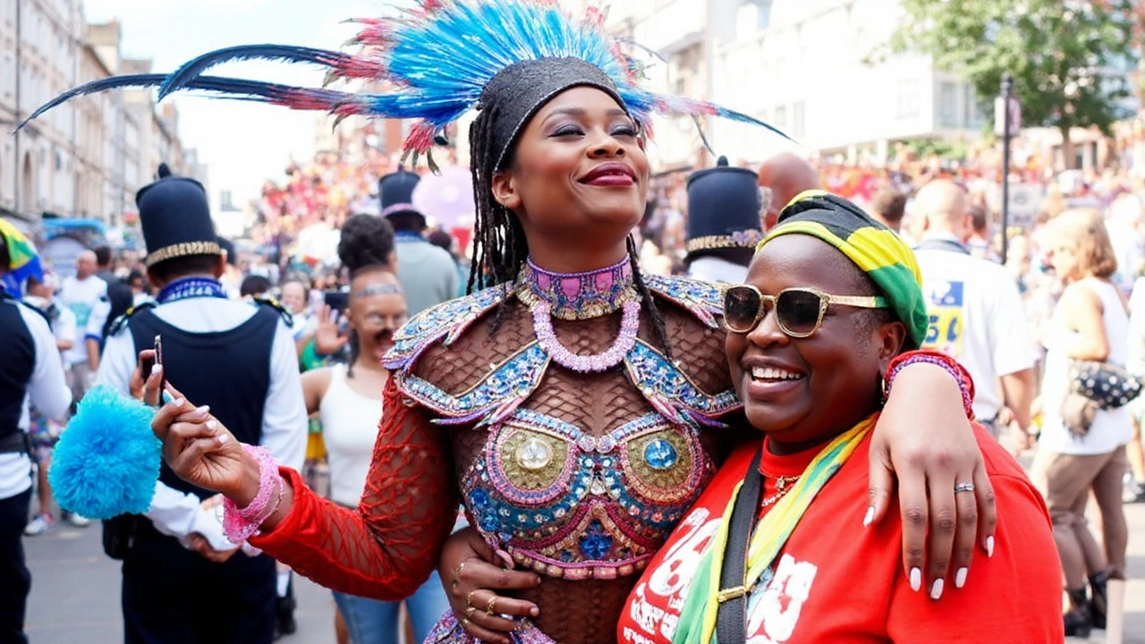
Two million people. More than three miles of parade. Hundreds of drums, horns, and sound systems shaking west London. Notting Hill Carnival 2025 runs over the August bank holiday weekend from Saturday 23 to Monday 25 August, marking the event’s 57th year and its status as Europe’s biggest street festival and the world’s second largest carnival after Rio.
The weekend follows a familiar rhythm, each day with its own identity and crowd. If you’ve never been, think of it as three events wrapped into one city takeover.
Saturday 23 August — UK National Panorama Steelband Competition (ticketed): the country’s best steel orchestras go head-to-head in a showcase of precision and power. The competition is organised with the British Association of Steelbands and typically runs in the evening. Expect full-size steel orchestras performing arranged calypso and soca pieces, with a lively crowd and food vendors. Tickets are required for entry and bag checks are normal.
Sunday 24 August — Family Day (free): this is the softer landing. The morning starts with J’ouvert, the traditional break-of-dawn procession known for paint, powder and rhythms that roll before most people have had their coffee. Later, the Children’s Parade takes the spotlight with junior Mas bands, smaller floats and gentler sound levels. If you’re bringing kids, this is your best bet.
Monday 25 August — Adults Day (free): the volume ramps up. The main parade fills the route and sound systems push deeper bass. Expect ‘Dutty Mas’ energy: high-tempo soca, big crowds, and the Judging Zone where Mas bands present their costumes for points. This is the busiest day, so plan your route in and out before you arrive.
Carnival’s soundtrack is broad. Soca, calypso and steelpan lead the way, but you’ll hear reggae, dancehall, jungle, drum and bass, house, amapiano and more. Alongside the trucks and bands, dozens of static sound systems anchor street corners and squares with curated line-ups—some legendary, some up-and-coming—each with its own crowd and vibe.
Food powers the day. Expect grills smoking with jerk chicken, jerk pork and corn on the cob; patties, curry goat, rotis, doubles, plantain, fresh juices and shaved ice. Card payments are more common now, but with mobile signal often congested, cash can save you time in queues.
The council supports navigation with a detailed event map. It marks the parade route, Judging Zone, sound system locations, licensed street trading areas, St John Ambulance first-aid points, toilets and road closures. There’s also a simple “What is near me” tool to locate facilities quickly once you’re inside the footprint.
Music usually winds down in the early evening; sound systems stop first, then the parade wraps up not long after. If you want space to breathe, arrive earlier in the day and drift to the edges by late afternoon.
Route, map, travel and safety
The main parade weaves through west London for more than three miles. It starts near Westbourne Park station on Great Western Road, tracks along Westbourne Park Road and Chepstow Road, swings onto Westbourne Grove, then heads down Ladbroke Grove—the longest, busiest stretch—before looping through Kensal Road and Golborne Road, and finishing on Elkstone Road.
Official float entry points are tightly controlled for safety. The confirmed entry gates are at both ends of Ladbroke Grove, at Great Western Road, and at North Pole Road. These areas get dense when trucks arrive and depart; steer clear of bottlenecks if you’re with children or a large group.
How to pick your spot? Ladbroke Grove delivers the full blast—costumes, big trucks, and the thickest crowds. Westbourne Grove is more open and better for families during the Children’s Parade. Chepstow Road and Golborne Road often feel more relaxed while still close to the action. The Judging Zone is where costumes slow down and show off; it’s good for photos and detail.
Expect rolling road closures across the weekend, with restrictions strongest on Sunday and Monday. If you live in the area, parking suspensions and access limits are standard, so move cars early and plan deliveries around the event footprint. Taxis and ride-hailing services cannot cross the route; agree on pickup points outside the closures.
Public transport is your friend, with caveats. Some stations near the route operate as exit-only at peak times, and some may close if platforms get too crowded. Check TfL’s weekend advice before you travel and be flexible if staff direct you to walk to a quieter station. Walking the last 15–20 minutes is often faster than trying to board at the closest stop.
- Common approach stations: Notting Hill Gate, Bayswater, Queensway, Westbourne Park, Ladbroke Grove, Royal Oak. Exact operating patterns can change on the day.
- Avoid driving. Road closures are extensive and parking is heavily restricted.
- Cycle with care. Crowds, diversions and glass underfoot make riding risky near the core footprint. Use bike parking away from the route.
Facilities are spread across the footprint. The event map highlights toilets (including accessible units), first aid posts run by St John Ambulance, and stewarded help points. Keep an eye out for signage as you move; it’s updated to reflect crowd flows.
Mobile coverage is patchy once the area fills. Don’t count on calls or data to find friends. Agree a rendezvous point outside the Carnival footprint before you set off, and pick a backup time and place if you get separated.
Bag size matters. Go small and hands-free. Large rucksacks make it harder to move through crowds and can attract pickpockets. Zip pockets help; so does carrying only what you need—ID, a bank card, some cash, portable charger, water, sunscreen, and tissues or wipes.
- Leave glass at home. Shops near the route often switch to cans or plastic for safety.
- Wear comfortable, closed shoes. Streets get sticky and uneven.
- Bring ear protection for children. Sound systems can be loud even at the edges.
- Dress for sun and showers. Late August in London can deliver both on the same day.
- Hydrate and eat. Long days plus heavy bass will wear you out faster than you think.
Accessibility has improved in recent years. The map marks accessible toilets and designated viewing areas near key stretches of the route, including parts of the Judging Zone. Stewards can assist with directions to quieter crossing points and accessible facilities. If you rely on battery-powered mobility aids, plan a charging strategy and identify the nearest first-aid or help point on arrival.
Families usually favour Sunday. Arrive earlier in the day, stick to wider streets, and keep moving with the flow. Write a contact number on a wristband or card for children and agree what to do if you get separated. Look out for stewarded reunification points and police officers—both can help quickly.
Security is visible and layered. You’ll see stewards at crossings, police managing crowd build-up, and medical teams from St John Ambulance stationed at regular intervals. Follow directions from staff, especially around road closures and truck movements. If an area feels too crowded, step back a block—there’s always another vantage point.
Carnival runs on community as much as it does on basslines. Born in 1966 out of Caribbean culture and local organising, it has grown into a three-day showcase of Mas bands, Brazilian groups, steel orchestras, dancers, and static systems that turn corners into open-air clubs. That scale requires serious logistics: overnight clean-ups, miles of fencing, and the careful sequencing of floats. Give crews space to work when you see them clearing or moving barriers.
Food and drink etiquette is simple: queue patiently, have payment ready, and bin your rubbish. Waste teams sweep through repeatedly but the area fills fast. Use the nearest bin or carry a small bag to pack out what you brought in. It keeps the streets safer and makes the clean-up faster for everyone living there.
Key things to remember:
- Dates: Saturday 23 August (Panorama, ticketed), Sunday 24 August (Family Day, free), Monday 25 August (Adults Day, free).
- Route: Great Western Road → Westbourne Park Road → Chepstow Road → Westbourne Grove → Ladbroke Grove → Kensal Road → Golborne Road → Elkstone Road.
- Float entry points: both ends of Ladbroke Grove, Great Western Road, North Pole Road.
- Maps and tools: council interactive event map plus a simple “What is near me” facility finder.
- First aid: St John Ambulance posts throughout the footprint.
- Crowd plan: meet outside the area, carry a small bag, and set a backup rendezvous.
If you want a calmer experience, start on the fringes, follow the parade for a stretch, then duck into a side street for food and a breather. If you want the full blast, stake out a spot on Ladbroke Grove on Monday and hold your ground. Either way, build in time to get home—stations near the route are at their busiest right after the music stops.
For residents and businesses inside the footprint, expect temporary closures, deliveries to be rerouted, and access passes where needed. Check local notices dropped through letterboxes in the run-up to the weekend. If you rely on care visits or medical appointments, confirm timings early and flag the road closures to providers so they can plan detours.
Above all, treat it like what it is: a giant, free, open-air celebration built on community, craft and sound. Plan well, travel light, and let the parade set the pace.


